Hawaii Tsunami Flood Zones Areas and Maps
Maps for Hawaii Tsunami Flood Zone Areas Including Honolulu and Oahu
The phenomenon we call a tsunami (soo-NAH-mee) is a series of waves of extremely long wave length and long period, generated in a body of water by an impulsive disturbance that displaces the water such as an earthquake, landslide, or sub-marine volcanic eruption. The term tsunami was adopted for general use in 1963 by an international scientific conference. Tsunami is a Japanese word represented by two characters: “tsu” and “nami.” The character “tsu” means harbor, while the character “nami” means wave. In the past, tsunamis were often referred to as “tidal waves” by many English speaking people.
Hawaii Flood Zone Areas
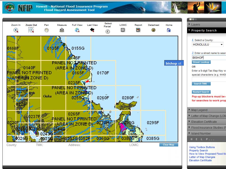
To see an Oahu flood zone map based on where you are located, the best place to find Hawaii tsunami flood zones, is the Hawaii Flood Hazard Assessment Tool. You can drill down to your location using the magnifier, or you can enter a Hawaii TMK (requires Silverlight) or Tax Map Key (if you have your property tax assessment, it’s listed on there). Do not enter the street suffix, such as “Road” or “Street.” Just enter the street name (see photo), such as “Bishop.” The map tool will then give you a selection for “Bishop St.” You then can narrow down the location. Link to the Pacific Warning Weather Center.
The term “tidal wave” is a misnomer. Tides are the result of gravitational influences of the moon, sun, and planets. Tsunamis are not caused by the tides, nor are they related to the tides, though a tsunami striking a coastal area is influenced by the tide level at the time of impact. The scientific community once referred to tsunamis as “seismic sea waves.” “Seismic” implies an earthquake-related mechanism of generation, which is often, but not always the case.
